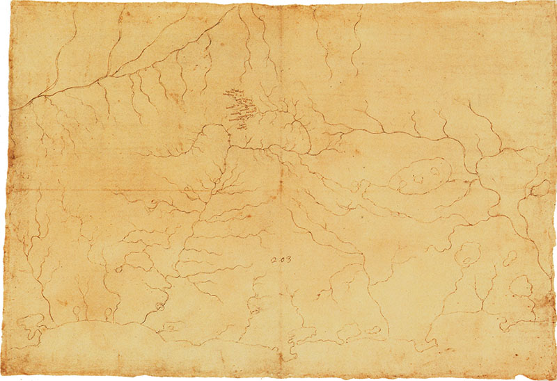
Codex Atlanticus, 910r. - Twelve localities in Casentino, c. 1502. The territory in question corresponds to the Windsor map (RL 12277) as does the hydrographic sketch (as if traced). Instead of the names of rivers, only those of 12 localities in Casentino appear: "Durbohc, Palagio, Porciano, Pratovechio, Stia, Fornace, Romena, Collina, Paglarecco, Bastinocco, Ponpana, Castel Castagnaio". Eleven place names have been identified in modern cartography, while "Bastinoccio" is present also on the earlier map of Massaio, between Pagliericcio and Castel Castagnaio, but has not been located on the terrain. It seems that Leonardo began this map in replacement of or as supplement to the preceding, mainly 'physical' one, with the intention of indicating cities and strongholds on it; the drawing remained unfinished but the cities most closely involved in the project for deviating the Arno (Florence, Prato, Pistoia, Pisa and perhaps Lucca) are already indicated by a conventional circle.
© Alessandro Vezzosi
Last update 26/feb/2008


