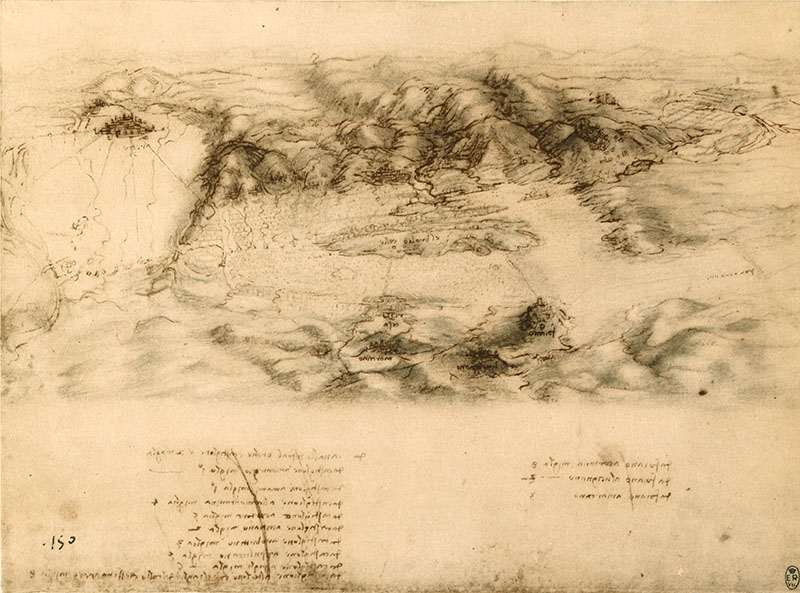
RLW 12682. - Bird's-eye view of Arezzo and the Val di Chiana with measurement of distances, c. 1502. This prospective view, sketched with signs of visual trajectories and chiaroscuro effects, should date from the time when Leonardo remained in Valdichiana during the rebellion of Arezzo, sustained by Vitellozzo Vitelli, one of Cesare Borgia's generals, against Florence. It was the spring/summer of that same 1502 in which, as documented by the dates and annotations of Ms. L, Leonardo travelled as far as the Marche and through Romagna. This is a first elaboration, in mirror writing, of a detail from map RLW 12278. It is an exemplary example of how Leonardo "constructed" a representation midway between a drawing of landscape done from nature and a topographical map proper, in a bird's-eye view re-invention; and of how he synthesized a view of perspective space and the measurement of distances. Downstream of Cortona appears – here as on map RLW 12278 – the path of the watercourse that joins the Chiana basin to Lake Trasimeno; in RLW 12277 Leonardo notes that this connection had been closed by Braccio da Montone (in the first half of the 15th century) and it is probable that he intended to restore it with a course not very different from that of today's Mucchia torrent. Interesting as regards methodology are the directrixes radiating out from Arezzo. The dimensions of the "Ponte a Pietra" and the "Ponte alla Nave", almost in the form of a dam, seem exaggerated here. Significant in the valley are the indication of Foiano and the central position of the "Brolio hill", overlooking the lake and port of the same name. The Brolio Lake was the object, starting from the first half of the 14th century, of various initiatives aimed at stabilising the water basin, improving the ecosystem and favouring fishing, culminating in the construction of the "Chiusa dei Monaci" (the Monks' Dam), a remarkable work of hydraulic engineering to control the outflow of the Chiana into the Arno.
© Alessandro Vezzosi
Last update 26/feb/2008


