History of the Road Network of Tuscany

Since antiquity, the development of a road network has always been the expression of a State’s organisational structure, being varyingly tied to necessities of an administrative, military or trading nature.The road system of today’s Tuscany sinks its roots in the major roads built during the Roman age, such as the Aurelia and the Cassia, which were the arteries from which a vast and intricate system of secondary roads developed, also in the centuries that followed.
Formation of the First Road System
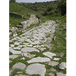
Since antiquity, the development of a road network has always been the expression of a State's organisational structure, being varyingly tied to necessities of an administrative, military or trading nature. More than of veritable roads with a pavement of slabs arranged on a solid foundation, the road system of pre-Roman Italy was formed by beaten earth tracks that generally followed the unevenness of the terrain and its irregular course. There were also important road works, however, which instead of adapting to the nature of the territory, sought to exploit its characteristics: for Tuscany, in particular, we can site the so-called "quarry roads" of the area around Sorano and Pitigliano, which were up to 3 metres wide and, at times, dug very deep into the tufa by the Etruscans.
It was the Romans, however, who stood out in road building, with the creation of a widespread road network which, with the exception of the most ancient routes, were characterised by a solid pavement and the realisation of important works of an engineering nature, such as bridges and tunnels, which made it possible to maintain a rectilinear course, even in the presence of large natural obstacles. The roadway of the most important roads was formed by a foundation composed of three successive layers of materials of decreasing dimensions (the statumen, a bed of rather large stones, followed by the rudus, a layer of mortar mixed with gravel, and in turn covered by the nucleus, a casting of mortar, sand and pozzolana), on which large slabs of flat stone were rested to form the road surface proper (pavimentum). The canonical width of these viae stratae measured around 4 metres; two sidewalks measuring about 2 or 3 metres in width were then added to these. The best conserved examples of Roman roads in Tuscany are found in Roselle. Of the Roman bridges in the region, only few remains survive: we can only suppose that, as the coeval bridges that survived in other parts of Italy and Europe, these were built prevalently utilising round arches formed by well-squared stone quoins.
From the Via Francigena to the Roads of Communal Tuscany
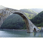
With the barbarian invasions and the disintegration of the Western Roman Empire, the consular roads – first conceived as vehicles of administration and trade – began to be considered as dangerous roads of penetration in the service of new invaders, and were therefore left to fall into decay. Even the Lombards who had settled in Northern Italy in the late 6th century were forced to define new routes when they realised the necessity to connect their kingdom to the duchies located beyond the Apennines. Indeed, what for centuries had been the major road connecting the north of the peninsula and Roma, that is to say the Via Flaminia, had remained under Byzantine control. Thus began the exploitation of a route which, following Charlemagne’s descent into Italy, was to become the most important trans-European road on the peninsula, known as the Via Francigena (or Via Romea). This was mainly a pilgrimage road which, with several byways such as those of the Apennine passes between Emilia and Tuscany, led from Canterbury to Rome. Though consisting of an unpaved "track", its importance led to the proliferation of infrastructures intended for the repose and care of wayfarers, at the same time accelerating cultural and commercial exchanges between regions.
The recovery of trade during the communal age was at the origin of creating additional communication arteries, built by exploiting valley lines, and centres of a political administrative nature, such as the "terre nuove" ["new lands"] and the market towns. The recollection of the ancient building techniques survived in the paved city streets, while for the construction of bridges, the round arch was gradually abandoned in favour of a lowered arch with a greater breadth of its lights and a consequent thickening of the abutments . One of the most famous examples is certainly the Ponte Vecchio of Florence which, despite successive restructuring, has preserved is fourteenth-century structure intact.
Road Network of Medici Tuscany
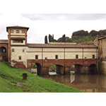
During the Renaissance, great personalities like Leonardo da Vinci (the Atlantic Codex, Manuscript B, etc.), Leon Battista Alberti (De re aedificatoria) and Andrea Palladio (I quattro libri dell’architettura), also devoted their attention to engineering problems tied to road systems. The most original contribution certainly came in the construction of bridges, a practise in which the scientists and architects of the epoch applied the results of the recent conquests in the field of mathematics and geometry. An emblematic case is the sixteenth-century project by Bartolomeo Ammannati of the Ponte Santa Trinita in Florence, the fundamental lines of which were recovered in the reconstruction accomplished at the end of World War II. The works of this period also include remarkable fortified bridges like the Medici bridge of Cappiano.
As for the road network, the layout of the communal period remains substantially unchanged under the early Medici. The conditions were not excellent, however, considering that the expense for the maintenance of roads was totally the responsibility of the various local communities, and the major works were performed almost exclusively on the occasion of important events tied to the prince’s interests, such as the arrival of Maria Magdalena of Austria, bride of the future Cosimo II. The Medici, however, did perform several interventions, especially in the Apennine area and in the reclaimed valley lines.
The "Road Revolution" of the Lorraine Period
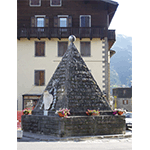
In the 18th century, Tuscany witnessed a period of great economic development, fruit of the illuminated policies of the new reigning dynasty, the Lorraines who, especially as of the second half of the century, distinguished themselves in the field of reforms and interventions on the territory. The plan to rationalise the grand-ducal road network included readjusting old routes and realising new thoroughfares, for the maintenance of which the Corpo degli Ingegneri di Acque e Strade was instituted in 1825. This was the period in which new theories relative to road construction techniques gained ground in Europe, such as that of Frenchman Pierre Marie-Jęrome Trésaguet, later picked up by Englishman Thomas Telford, which provided for a foundation of large stones laid between the sub-base and the roadbed, or the "prevailing" theory of Scotsman John Loudon McAdam, hence the term macadam which, on the contrary, prescribed a single layer of calcareous gravel.
In Tuscany, the protagonists of this "road revolution" were scientists and engineers of the calibre of Leonardo Ximenes, Alessandro Manetti, Giuseppe Salvetti and Pietro Ferroni. To them we owe several of the most daring freeways, such as the Abetone Modenese Royal Road, and some of the most fascinating works of civil engineering in Tuscany.
Following the proclamation of the Kingdom of Italy, this shrewd policy of interventions permitted Tuscany with its more than twelve thousand kilometres of roads to boast one of the best networks on the national territory.
Roads and Motorways in Contemporary Tuscany
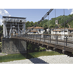
The period between the late 19th century and the early 20th century was one of intense and innovative realisations. Already in the 1830s, a successful attempt had been made to use iron to build suspension bridges, as testified by the Chain Bridge of Bagni di Lucca. The use of new technologies tied to materials like cast iron, steel and reinforced concrete made it by possible to create daring works which, still conserving the taste for the arch, were projected towards modern realisations with rectilinear structures, today obtained thanks to the use of prefabricated beams of prestressed reinforced concrete.
Even the carriageable roads that with the advent of the railway had lost a large part of their importance, received a new boost as of the late 19th century. Improvements were made to the services of public utilities, such as staging posts and inns, while roadways were adapted to the increased volume of carriageable road traffic. The macadam method proved obsolete faced with the new systems of automobile traffic. While the hooped wheel compressed the gravel pavement, recompacting and naturally consolidating it at every passage, the coming of the pneumatic tyre produced a suction effect on the material, provoking serious maintenance problems and the decision to remedy them by repaving the entire national road network with tar.
The first Italian motorways date to the 1920s and 1930s: among these, let us recall the Firenze-Mare (A11), of which the stretch between Florence and Migliarino Pisano was already inaugurated in 1933.
****************************
Texts by Elena Fani
English translation by Victor Beard
Last update 17/gen/2008


